Advantages of technology
Cluster collaboration technology, which leverages network node resources for information sharing, efficiently optimizes system performance, especially for hubless wireless communication networks. Autonomy and collaboration are the basis of group intelligence, and when individual autonomy has been developed rapidly, group autonomy and collaboration become one of the key technologies for the development of group intelligence.

Data Interface
Different types of data interfaces, such as Socket and RESTful, supports secondary development.

Flexible Deployment
The bracket can be moved quickly, supports single-area, multi-region, and grid area deployment.

Algorithm Support
TWR, TDOA, PDOA, water ripple, space-time chain, and other algorithms are all supported.

Positioning Accuracy
UWB (ultra-wideband ) communication protocol, which ensures high positioning accuracy.

Quick Setup
Combined products, detailed instructions, and perfect after-sales services, only 5 steps to setup.

Abundant Products
Tag variety is rich, the TG2 Goods positioning Tag that perfectly matches the UAV is included.


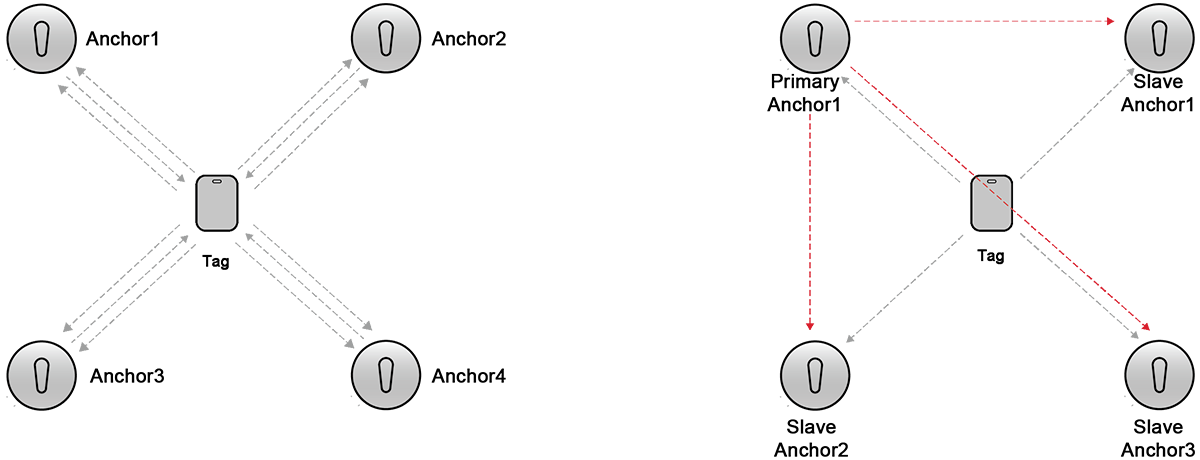
Single-Sided Two-Way Ranging (SS-TWR): A simple measurement of the round-trip delay of a single message from one node to another, and sending the response back to the original node. The error in this method of ranging increases with clock skew, and the error in the time-of-flight estimation increases to the point where the error makes the estimate very inaccurate.
Double-Sided Two-Way Ranging (DS-TWR): An extension of Single-Sided Two-Way Ranging (SS-TWR), in which two round-trip time-to-date measurements are used and combined to obtain time-of-flight results. Assuming that devices A and B are 100m apart, the flight time of electromagnetic waves is 333ns. Because the clock input error is 2033310-9 seconds, resulting in a ranging error of 2.2mm, it can be ignored. Therefore, bilateral ranging is the most commonly used ranging method.

Product Specifications


Platform Functions
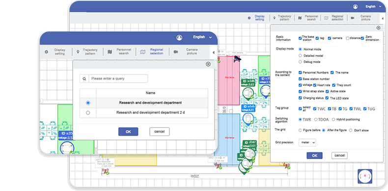
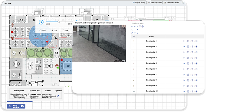
2D View
The anchor is set at the four corners of the area and 2.5 meters higher than the drone, which can make it cover a wider area. The anchor's built-in or external high power and gain omnidirectional antenna, which transmits data through the RJ45 network cable, can reach a maximum speed of 100–500 Mbit/s, the response time is only 0.1 ns. The real-time location data of the drone can be visualized, which allows users to better monitor the position of the drone.


Zone Management
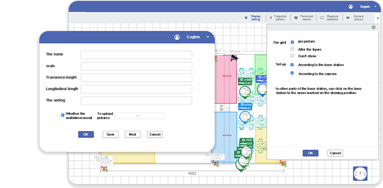
Importing e-maps allows users to quickly build indoor maps on the UbiTrack platform and locate them. Maps can be edited on the UbiTrack platform by adding information and functions. The self-calibration of the anchor can calibrate the parameters on the anchor floor plan, just follow the instructions to perform the corresponding operation on the UbiTrack platform, and the system will automatically identify the position parameters of the anchor and perform calibration.


Advanced service
 UbiTrack Partner Solutions

Building upon the mature product and diversified applications of the UbiTrack positioning system, UbiTtrack has launched Partner Solutions, you can get the hardware API and settings of the UbiTrack system and access to the private platform.
 UbiTrack Software Grading Services
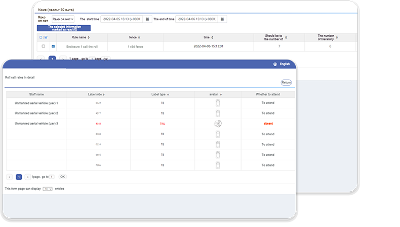
Building upon the mature product and diversified applications of the UbiTrack positioning system, UbiTtrack has launched the Software Grading Services. These are providing personnel management features, alarm information, 3D view, and many other features.

